Wednesday, January 29, 2014

The End is Nigh!

maps k, l

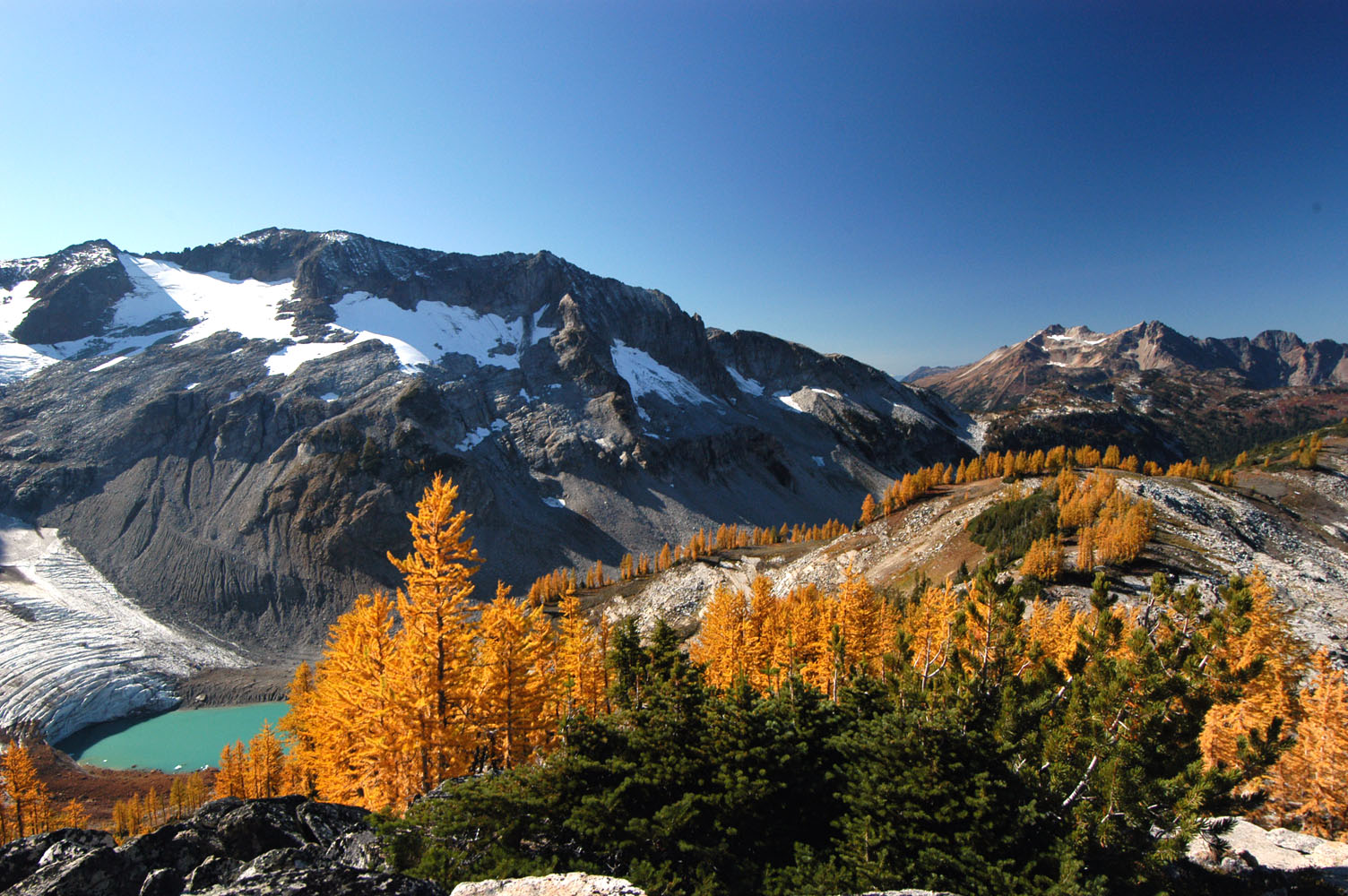
I think if I were looking for a vacation and I came across a place called Glacier Peak Wilderness, I would have heavenly dreams until I arrived. What could be better than alpine lakes, glaciers, and rock? I'm unsure. Reading the description on wilderness.net made me sentimental for my exploring days in CO; "bodies of water include more than 200 lakes, many unnamed and tremendously difficult to access, in various cirques and hidden basins." It is also a climbers haven. I might just stay here for a bit hoping to meet up with a buddy of mine who may be climbing in the area.

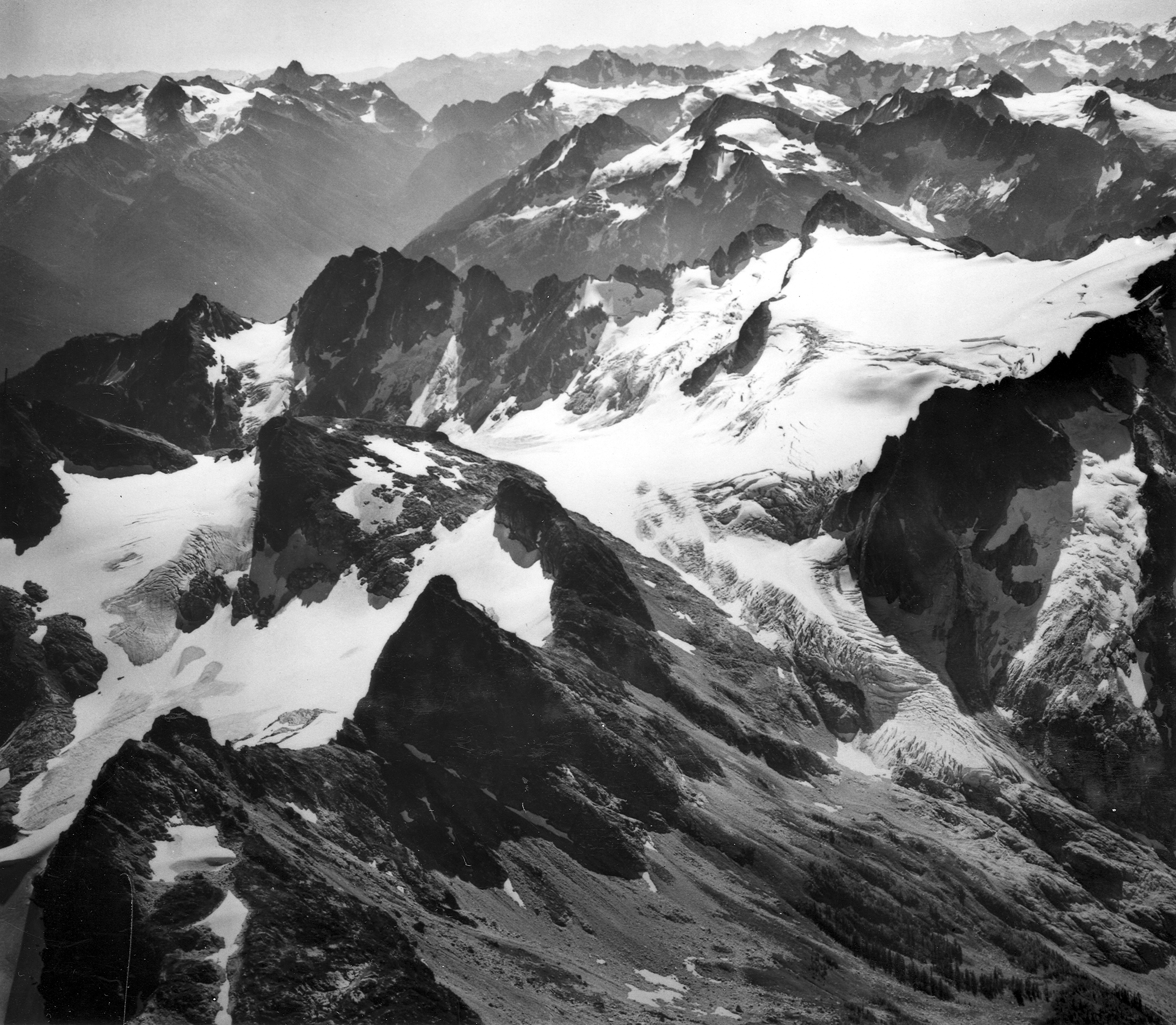
North Cascades National Park is glacier after glacier; 318 or so actually. All beautiful but also it will be sad. These landscapes are disappearing quickly, but that makes me all the more anxious to enjoy them while I can. here

Okanogan National Forest is the second largest NF that is completely in one county after Nez Perce National Forest in Idaho. The western side of the forest is wetter than the dry eastern side. The majority of the forested area is Lodgepole pines.

Hiking through WA we get to Cananda. Into that place we have all heard of, Manning Park. The park is named after Ernest Callaway Manning, Chief Forester from the 1930s to 41 when he died in a plane crash. He was apparently inspirational in encouraging British Columbians to set aside land for the enjoyment of future generations. I say apparently because I have not done much research on figuring out whether that statement is true. Manning park has a resort that is heavily trafficked by visitors world wide. Here is a history of manning park if you are interested.

Rock Climbing:
SO this is all the climbing we will pass in WA on the PCT.
Bridge of the Gods Boulders I hope to be better at bouldering by this point because the easiest problems are V4 and up to V12. Stretch Arm is a V5 problem there that looks so much fun.
Mount Adams will probably be added to my side trips.
Tieton River there is a 5.10 route there named the Saint of Circumstance that looks like a fun, hover hung crux.
Snoqualmie Pass has a few routes that I can go without rope so that seems fun.
There is a 5.8 traverse on Guye Peak.
That's all for now folks! More gear talk to be had in a bit.

Tuesday, January 28, 2014

Washington State! Active volcanos and all.

I've been working extra hours and training for the trail so I have been running short on time to write. This trend will probably continue so today and tomorrow, I'm finishing up my trail summary. I feel bad for Washington because this always happens to it. CA and OR are written about with love a detail and then WA gets the "I can't believe I'm almost done"/ "snow!" treatment. I'm about to give it the short end of the stick once again. I'll try to treat the trail like a good book and never think about the end until it has arrived, but for now, because of time management issues, I will have to write quickly about a walk through the state.

maps h, i, j

By the time we pass over the Bridge of the Gods, we are in WA.
The Columbia River Gorge National Scenic Area (CRGNSA) is the 24,000 acres around the Columbia River. The River is the second largest in North America, starting in Idaho and ending at the Pacific. The gorge is 4,000 feet deep at it's lowest point and includes the second largest waterfall in the world, Multnomah Falls.

Gifford Pinchot National Forest is nothing short of epic. It has Mt Adams, Mt St. Helens, Goat Rocks Wilderness, and huckleberries (yum). We will walk through patches of Gifford Pinchot that are apart of the Wind River Experimental Forest. These lands have been studied since 1909 when Thorton T. Munger set up an arboretum.

On the PCT we walk the entire Indian Heaven Wilderness from north to south, just over 16 miles. In the north there is a section named the Sawtooth Berry Flats where native americans collected huckleberries. To this day there is a section which is designated for the use of local tribes. Check out the Huckleberry Legend from the Yakima tribe. The summary is the Huckleberries are the plants that grew from the bloody eyes of the creator.

Goat Rocks Wilderness is spectacular. Not only do I love goats, but I love rough and rocky areas. This place looks heavenly. (photo) Jagged and lovely, can't wait to skit the sides of this range.

Mt. Baker-Snoqualmie National Forest is huge. It extends a 140 miles from the Canada down to Mt, Rainer National Forest. Outside of Alaska, it has the most glaciers of any national forest. We pass through Alpine Lakes Wilderness, which is mostly in Wenatchee National Forest. It has 700 mountain lakes and craggy peaks and ridges.


Sunday, January 12, 2014

Oregon's highest peaks

maps e, f, and g

Willamette National Forest includes the second through the fifth highest peaks in Oregon. Numbers 3-5 are the Three Sisters. Besides including the North, Middle, and South Sister volcanos, the area also claims the prize of being the second largest wilderness area in Oregon.
Nestled right before to these bad boys is the Mink Lake Basin. I was interested from the map view because it's just one lake right after the other. I can't imagine it being anything but foggy and generally wet. Then I stumble upon this photo on the forest service website..

After going from the lake basin to the alpine meadow of the Three Sisters we head into the wilderness of the lesser known Mount Washington. Unlike its east coast counterpart, Mount Washington is Oregon is not very statistically impressive. But it is beautifully dynamic.

I would love to come back in the winter for an ascent. The PCT falls between Big Lake and the Dee Wright Observatory.

Willamette's highest point is second highest in Oregon: Mt Jefferson. It is a stratovolcano with 5 glaciers melting on it's sides.  The area is designated as Mount Jefferson Wilderness. There are populations of bald eagles that nest in the area feed off the 150 trout stocked lakes.

Map g ends in the Mount Hood National Forest. The trail skirts around the bottom of Mt Hood where we are sure to find day hikers and wanderers alike. Mt Hood is considered the most likely volcano in Oregon to erupt, but the chances of that are not very likely. If we are lucky enough we will be able feel an earthquake around it, but something tells me we won't find small earthquakes to be so odd after walking the San Andreas fault through California.

Flora:
The trees throughout this region are mostly fir (subalpine, douglas, silver) along with ponderosa and lodgepole pine and mountain and western hemlock. Look out for huckleberry, rhododendron, and vine maple. Lovely little flowers named red paintbrush, lupine, bear grass, and lily. Plus I really hope to find some marionberries...

Climbing:
After such a dry spell we are back in climbing business.
First up the Three Sisters Wilderness. Then to Greens Spring near Hwy 66 for some non alpine ascents. Off to Snoqualmie Pass for some easy and short routes perfect for free climbing. Of course Mount Washington, Mount Jefferson and Mount Hood.
Then map g ends near some bouldering at Cascade Boulders.


Wednesday, January 1, 2014

Oregon! So Many Lakes, including Crater Lake

maps b,c, and d

Oregon looks like heaven even from GoogleEarth. It is not as high in elevation as the Sierra's in CA but the landscape is just as dramatic. The Cascades were volcanically active till about 5-3 million years ago. Lava rock always makes for dynamic landscapes. When water hits lava rock it can easily chew some rock and leaves the harder dikes behind. These volcanoes were active during the last ice age and show the scars of glacial battle. Glaciers create sheer rock faces and nice scoops for lakes. Sky Lakes Wilderness in Fremont-Winema National Forest is apart of this glacier lake arena. It has 200 pools of water including a few that have the most chemically pure water known on the planet.

Winema National Park is right before Crater Lake. In the lower levels of the park by the Williams River drainage and Upper Klamath Lake the land opens to vast marshes. In the sections we will be walking through there is the Sky Lakes wilderness and the old growth of ponderosa pines and lodgepole pines. The National Park used to be apart of the Klamath Indian Reservation until the 60s and 70s when the US government bought the land from them. The Klamath Indians still have special land use rights.

Crater Lake National Park is up next. We pass by Mazama Village. Crater Lake is actually a caldera lake. It was formed by the collapse of the volcano Mount Mazama. It is the deepest lake in the United States. I hear from previous PCTers that the Crater Lake Rim Alternate Route is one of the most memorable sections of hiker trail. The official PCT technically goes just west of Crater Lake, but that is so horses can travel it. Personally, I'm going to take the hiker PCT so I can see this up close and personal :)


Mount Thielsen in Umpqua National Forest is another volcano in this range, but it experienced a different death then Mount Mazama. Instead of collapsing, Mount Thielsen has been heavily eroded by water and glaciers. It almost looks like a volcano skeleton. I hear from a previous PCTer that you can climb to the top...guess what I will be doing as a side trip :)

Diamond Peak Wilderness is in the Deschutes National Forest. Below is the photo of Diamond Peak form the PCT. We pass in between Cresent Lake and Diamond Peak.